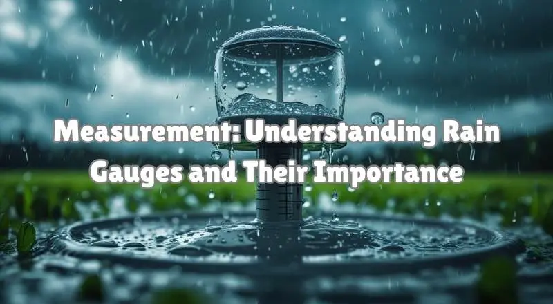
Definition of Rain Measurement
Rain measurement is the systematic process of quantitatively determining the depth of precipitation, typically rainfall, that accumulates over a defined area during a specific interval of time. This involves employing various instruments and techniques to capture and measure the vertical depth of water that would collect on a level, impermeable surface if there were no runoff or infiltration. The standard unit of measurement is usually millimetres (mm) or inches.
Significance of Measuring Rainfall
The accurate measurement of rainfall holds paramount significance across a multitude of sectors:
- Agriculture: Precise rainfall data is crucial for effective agricultural planning and management. Farmers rely on this information to determine optimal planting schedules, irrigation requirements, and the expected crop yields. Deviations from normal rainfall patterns can significantly impact agricultural productivity, leading to potential water stress or waterlogging of crops. Long-term rainfall records also aid in understanding regional climate patterns and adapting farming practices accordingly.
- Water Resource Management: Rainfall is the primary source of freshwater in most regions. Accurate measurements are essential for managing water resources efficiently. This includes monitoring the availability of water in reservoirs and rivers, forecasting potential droughts or floods, and making informed decisions regarding water allocation for domestic, industrial, and environmental needs. Hydrological models heavily rely on rainfall data to predict water flow and availability.
- Weather Forecasting: Rainfall measurements are a fundamental component of weather forecasting and climate monitoring. Meteorologists use this data, often collected from a network of rain gauges and remote sensing technologies like weather radar and satellites, to track the movement and intensity of precipitation systems. This information is vital for issuing timely warnings about heavy rainfall events that could lead to flooding or other weather-related hazards. Furthermore, long-term rainfall data contributes to our understanding of climate variability and change.
Types of Rain Gauges: A Comprehensive Overview
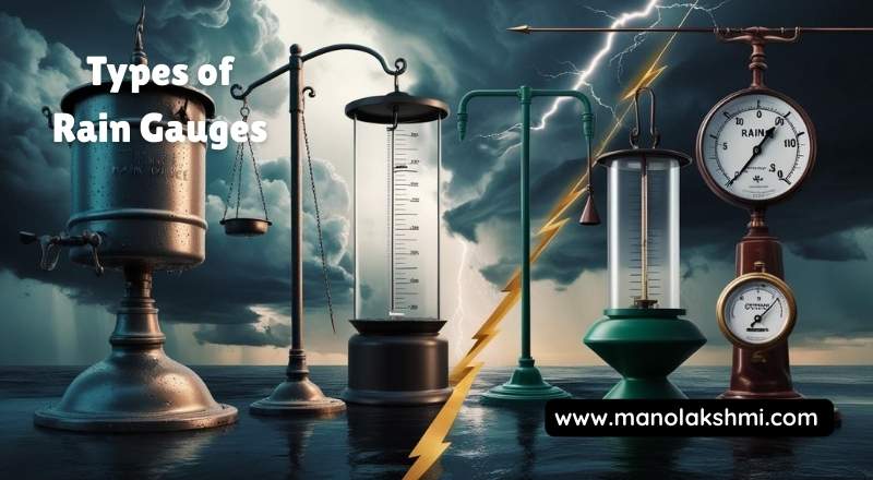
Rain gauges are essential meteorological instruments used to measure the amount of liquid precipitation (rain) over a specific period. Reliable rainfall information is vital for hydrology, agriculture, weather prediction, and climate research. Different types of rain gauges have been developed, each with its own principles of operation, advantages, and limitations.
Standard Rain Gauge:
A common and time-tested approach to manually measuring rainfall is using the standard rain gauge. It typically consists of a cylindrical collector with a funnel at the top. This funnel directs the collected rainwater into an inner measuring tube. The diameter of the collector is usually standardised to ensure consistent measurements across different locations. The measuring tube is calibrated with markings to allow. For direct reading of the accumulated rainfall, typically in millimetres or inches.
- How it works: During a rainfall event, water falls into the collector and is channelled through the funnel into the measuring tube. After the rain stops, an observer manually reads the water level in the measuring tube to determine the total rainfall for that period. The collected water is then emptied, and the gauge is ready for the next rainfall event.
Tipping Bucket Rain Gauge:
The tipping bucket rain gauge is an automated instrument designed for continuous rainfall measurement. Its key component is a small, seesaw-like mechanism consisting of two small buckets balanced on a pivot. Below the collecting funnel, the rainwater is directed into one of the buckets.
- Explanation of the mechanism: When a predetermined amount of rainfall (e.g., 0.2 mm or 0.01 inches) accumulates in one bucket, the weight causes it to tip over. Pour out the water while immediately placing the next empty bucket beneath the funnel to continue the collection process. A tipping bucket rain gauge produces an electrical signal with each tip, which is then recorded by a data logger.
- Advantages: Tipping bucket rain gauges offer key benefits: continuous rainfall data collection and easy automatic data logging. This allows for the analysis of rainfall intensity and duration, which is valuable for various hydrological and meteorological studies. The automated nature reduces the need for manual observation after each rainfall event.
Electronic Rain Gauges:
Various sensor types are employed in electronic rain gauges for rainfall detection and measurement. These sensors can employ different principles, such as optical, capacitive, or ultrasonic methods, to determine the amount of precipitation.
- Utilisation of sensors: Optical rain gauges, for instance, may use a laser beam and a detector. Rainfall passing through the beam causes scattering or attenuation of the light. Which is then correlated to the rainfall intensity and accumulation.
Capacitive sensors measure the change in capacitance caused by the accumulation of water on a sensing surface. Ultrasonic sensors emit sound waves and measure the time it takes for the waves to reflect back from the raindrops, providing information about rainfall intensity.
- Benefits: Electronic rain gauges offer several benefits, including the potential for real-time data transmission to remote locations. This allows for immediate access to rainfall information, which is crucial for flood monitoring and early warning systems. Additionally, these gauges can often provide more detailed data and support advanced analytics, such as rainfall intensity profiles and droplet size distribution in some sophisticated models.
Weighing Rain Gauge:
A weighing gauge functions by determining the weight of the water it collects. Precipitation falls into a container and a weighing mechanism. Such as a spring balance or a load cell, continuously measures the increasing weight of the accumulated water.
- Description of the system: The weight measurements are then converted into rainfall depth using a known relationship between the weight of water and its volume. The data is typically recorded electronically. Providing a continuous record of rainfall accumulation over time.
- Accuracy and suitability: Weighing rain gauges are known for their accuracy. As they directly measure the mass of the collected water. Which is less affected by factors like rainfall intensity compared to some other types of gauges.
They are also suitable for measuring all forms of precipitation, including rain. Snow and hail, as the weight measurement remains consistent regardless of the phase of the precipitation. This makes them particularly valuable for scientific applications. That require precise measurements of total precipitation, especially in regions with mixed precipitation types.
How Rain Gauges Function

Rain gauges are fundamental instruments for collecting and measuring precipitation, providing crucial data for various applications, including weather forecasting, hydrological studies, and agricultural planning. Their basic function involves capturing rainwater and quantifying the amount collected over a specific period. The accuracy and reliability of rain gauge measurements depend on several key aspects, including the collection mechanism, the measurement process, and proper calibration.
Collection Mechanism
Rain gauges begin operation by effectively collecting falling rainwater.This is typically achieved through a collector, which is the exposed opening at the top of the gauge. A collector’s design is crucial for accurately channeling all precipitation from a specific area into the measuring device. Standard rain gauges typically use a circular collector with a sharp, beveled edge to reduce splashing and maintain a uniform collection area.
The size of the collector’s opening is a crucial factor, as it determines the volume of water captured and, consequently, the resolution of the measurement. Collected water flows from the collector through a funnel and into a measuring container or mechanism.
The materials used for the collector and funnel are usually non-corrosive to prevent contamination of the collected rainwater and ensure the longevity of the instrument. In some advanced rain gauges, heating elements may be incorporated around the collector to melt any snow or hail. Ensuring that all forms of precipitation are measured in their liquid equivalent.
Proper installation of the rain gauge is also essential for accurate collection. It should be placed in an open area, away from obstructions like trees and buildings that could interfere with the falling precipitation. The gauge should also be mounted horizontally to ensure that the collecting area is level.
Measurement Process
Once the rainwater is collected, the next step is to accurately measure its quantity. Rain gauges employ different methods for this purpose, broadly categorized as volume-based or weight-based measurements.
- Volume-Based Measurement: The most common type of rain gauge utilizes a graduated cylinder or a tipping bucket mechanism to measure the volume of collected water. In a simple graduated cylinder rain gauge, the collected water accumulates in a calibrated container, and the amount is read directly from the markings on the cylinder.
These gauges are typically read manually after a specific time period. Automated rainfall measurement can be achieved using tipping bucket rain gauges. They consist of a pair of small buckets pivoted beneath the funnel.
When one bucket collects a predetermined amount of water (e.g., 0.01 inches or 0.25 millimeters), it tips over, emptying the water and simultaneously positioning the other bucket under the funnel. Each tip is recorded electronically, providing a time-resolved measurement of rainfall intensity and accumulation.
- Weight-Based Measurement: Weighing rain gauges offer a more advanced method for measuring precipitation by determining its weight. These gauges typically consist of a container placed on a sensitive weighing scale. Rainwater collection in a container leads to a measurable increase in weight. Weighing rain gauges accurately measure all precipitation types (rain, snow, hail) by measuring their weight, regardless of their liquid or solid state.
They are also less susceptible to errors caused by evaporation. Especially if the collected water is stored in a sealed container. Electronic weighing rain gauges offer significant advantages for research and hydrological monitoring due to their ability to deliver high-resolution and real-time data.
Calibration:
A Calibration is a critical process for ensuring the accuracy of any measuring instrument, and rain gauges are no exception. Calibration involves comparing the measurements from the rain gauge with a known standard to identify and correct any systematic errors.
- Importance of Calibration: Accurate rainfall information is essential for a variety of applications. Incorrect measurements due to an uncalibrated or poorly calibrated rain gauge can lead to flawed hydrological models, inaccurate weather forecasts, and ineffective water resource management. Consistent and reliable long-term data from a rain gauge is ensured through regular calibration.
- Calibration Procedures: The specific calibration procedure for a rain gauge depends on its type. For graduated cylinder rain gauges, calibration involves verifying the accuracy of the volume markings on the cylinder. This can be done by adding known volumes of water and checking if they correspond to the indicated levels. For tipping bucket rain gauges, calibration involves adjusting the tipping mechanism so that each tip corresponds to the correct amount of rainfall.
Rain gauge calibration involves verifying recorded tips against a known volume of introduced water or checking weighing gauge accuracy with known weights.
- Frequency of Calibration: The frequency of calibration depends on factors such as the type of rain gauge, its exposure to the elements, and the required level of accuracy. Generally, rain gauges should be calibrated at least annually. However, more frequent calibration may be necessary in harsh environments or for critical applications.
Regular maintenance, such as cleaning the collector and ensuring that the moving parts are functioning smoothly. Is also essential for maintaining the accuracy of rain gauge measurements between calibrations.
Importance of Rain Measurement
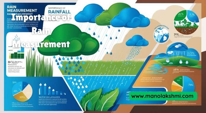
Rain measurement is a crucial aspect of various scientific and practical disciplines, providing fundamental data with far-reaching implications across multiple sectors. Accurate and consistent rainfall data enables informed decision-making. Supports crucial planning processes, and contributes significantly to our understanding of the environment and its dynamics.
Agriculture
In agriculture, rainfall data plays an indispensable role in optimizing irrigation planning and implementing effective crop management strategies. Farmers can use information about rainfall amount, intensity, and timing to accurately determine when and how much to irrigate their crops.
This precision helps avoid under-irrigation, which stresses plants and lowers production, and over-irrigation, which wastes water and harms the soil. Furthermore, rainfall data informs crucial decisions regarding planting schedules.
The application of fertilizers and pesticides (as rainfall can affect their efficacy and longevity), and harvesting times. Historical rainfall patterns also guide the selection of suitable crops for a particular region and the development of drought-resistant varieties. Accurate data is crucial for ensuring food security and fostering sustainable agricultural practices.
Hydrology and Water Resources
For the field of hydrology and the effective management of water resources, rainfall data is essential. Understanding the water cycle, calculating surface runoff, and estimating groundwater recharge are all based on this. This information is critical for managing freshwater supplies, particularly in regions prone to water scarcity.
Rainfall data is also fundamental to flood forecasting and the development of early warning systems. Allowing for timely evacuation and mitigation efforts to protect lives and property. Engineers and water resource managers rely on historical and real-time rainfall data to design and operate dams, reservoirs, and other water infrastructure, ensuring efficient water storage and distribution.
Moreover, understanding rainfall patterns is crucial for assessing the impact of climate change on water availability and planning for future water needs.
Climate Research
Rainfall measurements are a vital component of climate research, contributing significantly to our understanding of climate change and the development of accurate weather models. Long-term rainfall data sets provide valuable insights into historical climate variability and trends.
Allowing scientists to identify shifts in precipitation patterns and their potential causes. This information is crucial for validating and improving climate models. Which are used to predict future climate scenarios and assess the impacts of greenhouse gas emissions.
Rainfall data, in conjunction with other meteorological variables, helps researchers study extreme weather events. Such as droughts and floods, and to better understand the complex interactions within the Earth’s climate system.
Accurate rainfall measurements are therefore indispensable for advancing our knowledge of climate change and informing mitigation and adaptation strategies.
Urban Planning:
In urban planning and development, rainfall data is a critical input for designing effective drainage systems and mitigating flood risks in urban areas. Impervious surfaces in cities, such as roads and buildings, increase surface runoff and can overwhelm drainage infrastructure during heavy rainfall events, leading to urban flooding.
Historical rainfall data, including information on the frequency and intensity of storms. Is used by engineers to design storm sewers, culverts, and other drainage systems. With sufficient capacity to handle expected rainfall volumes.
Understanding local rainfall patterns also informs decisions regarding land use planning. The location of critical infrastructure, and the implementation of green infrastructure solutions. Such as permeable pavements and green roofs, which can help to manage stormwater runoff and reduce flood risks in urban environments.
Effective urban planning, informed by rainfall data, is essential for creating resilient and sustainable cities.
Challenges in Rain Measurement
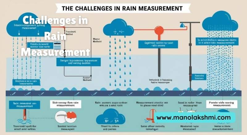
Rain measurement, while seemingly straightforward, is fraught with complexities that can significantly impact the accuracy and reliability of collected data. Several factors contribute to these challenges, requiring careful consideration in hydrological studies, weather forecasting, and various other applications.
Variability in Rainfall
Rainfall is an inherently dynamic and spatially variable phenomenon. Its occurrence and intensity can differ dramatically over short distances and time scales. Convective storms, for instance, often produce highly localized and intense rainfall events that may be missed entirely by a rain gauge located just a few kilometers away.
Orographic effects, where mountains force air upwards, leading to precipitation on one side and a rain shadow on the other, further contribute to this irregularity. Accurate rainfall estimation and hydrological modeling require understanding and accounting for spatial and temporal variability.
Traditional rain gauge networks, with their discrete measurement points, often struggle to capture the full spectrum of rainfall variability. Leading to potential underestimation or overestimation of precipitation in ungauged areas. Advanced techniques like radar and satellite-based rainfall estimation. Can provide broader spatial coverage but come with their own sets of uncertainties and limitations.
Gauge Location
Accurate rainfall data heavily depends on where the rain gauge is located. An inappropriately located gauge can provide misleading information, undermining the value of the entire measurement effort. Rain gauge accuracy can be substantially affected by obstructions like trees, buildings, and nearby slopes. These obstructions can create wind eddies that deflect raindrops away from the gauge orifice, leading to systematic underestimation.
Similarly, gauges placed in depressions or areas prone to ponding may collect runoff, falsely inflating rainfall measurements. Rain gauges work best in open, flat areas away from obstacles.
Guidelines and best practices for gauge siting emphasize the need for a clear sky view and sufficient distance from any potential interfering objects. Furthermore, accessibility for maintenance and data collection should also be considered when selecting a gauge location.
Maintenance Issues
Regular and diligent maintenance is essential for ensuring the proper functioning and accuracy of rain gauges over time. Neglecting maintenance can lead to a variety of problems that compromise the reliability of the collected data.
Debris such as leaves, dust, and bird droppings can accumulate in the gauge orifice or the collection funnel, obstructing the flow of rainwater and leading to underestimation.
In tipping bucket rain gauges, even minor blockages can affect the precise tipping mechanism, resulting in inaccurate readings. Similarly, mechanical parts can corrode or become misaligned over time, requiring cleaning, lubrication, or replacement.
Automated rain gauges rely on sensors and data loggers that require periodic checks and calibration to ensure their accuracy. Battery failures, communication issues, and software glitches can also disrupt data collection.
A consistent maintenance schedule, including regular inspections, cleaning, and calibration, is crucial for obtaining high-quality rainfall data. Furthermore, proper documentation of maintenance activities is important for identifying potential sources of error and ensuring the long-term consistency of the measurements.
Advances in Rain Measurement Technology
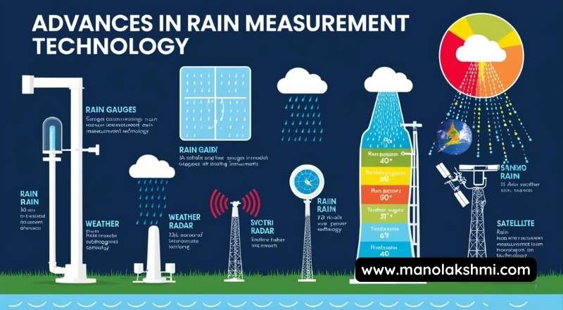
Remote Sensing Techniques
Satellite and radar technologies have revolutionized large-scale rain measurement by providing comprehensive spatial and temporal coverage. Weather satellites equipped with passive microwave and infrared sensors can estimate rainfall intensity and accumulation over vast areas, including oceans and remote regions where ground-based observations are scarce.
Doppler radar systems, both ground-based and airborne, offer high-resolution precipitation data by detecting the movement of raindrops. These remote sensing techniques are crucial for monitoring weather systems, tracking storms, and improving hydrological models for flood forecasting and water resource management.
Ongoing advancements focus on enhancing the accuracy and resolution of these measurements. Integrating data from multiple sources, and developing algorithms to better distinguish between different types of precipitation.
Citizen Science Initiatives
Citizen science initiatives harness the power of community participation in collecting rainfall data using simple, standardized rain gauges. This approach can significantly increase the density of ground-based observations, especially in areas with limited official monitoring networks. Volunteers contribute valuable data by recording rainfall amounts at their locations and sharing them through online platforms or mobile applications.
These initiatives not only provide supplementary data for weather monitoring and research but also raise public awareness about rainfall variability and its impact on local communities. Quality control measures and data validation techniques are essential to ensure the reliability of citizen science data.
Integration of Artificial Intelligence
The integration of artificial intelligence (AI) and machine learning (ML) techniques is transforming rainfall prediction based on the vast amounts of data collected from various sources, including remote sensing, ground-based stations, and citizen science initiatives.
Artificial intelligence algorithms excel at uncovering intricate patterns and correlations within large datasets, revealing insights that traditional statistical analyses might miss. By analyzing historical rainfall data, atmospheric conditions, and other relevant factors, AI models can generate more accurate and timely rainfall forecasts at different spatial and temporal scales.
These advanced predictions are vital for various applications, such as agriculture, water management, disaster preparedness, and transportation planning. Further research focuses on developing more robust and explainable AI models that can account for the inherent uncertainty in weather forecasting.
Conclusion:
Rain gauges, seemingly simple instruments, play a vital role across a multitude of disciplines. For meteorologists, they provide essential ground truth data for weather forecasting and climate modeling, allowing for the calibration and validation of more complex remote sensing technologies like radar and satellites.
In hydrology and water resource management, accurate rainfall measurements are crucial for assessing water availability, predicting streamflow, designing and managing reservoirs, and mitigating flood risks.
Agriculture relies heavily on rainfall data for irrigation scheduling, crop yield prediction, and understanding the impact of precipitation on plant health and disease. Furthermore, engineers utilize rainfall intensity and duration data for the design of drainage systems, bridges, and other infrastructure to ensure resilience against extreme weather events.
Environmental scientists depend on long-term rainfall records to study climate change impacts on precipitation patterns, understand ecological responses to varying water availability, and monitor drought conditions. Ultimately, rain gauges serve as fundamental tools for understanding our complex water cycle and informing critical decisions in diverse sectors.
Future Prospects in Rain Measurement:
The field of rain measurement is continually evolving, driven by advancements in technology and the increasing need for more precise and spatially comprehensive data. Future trends point towards the integration of various sensing technologies.
We can anticipate the development of more sophisticated and affordable tipping bucket rain gauges with higher resolution and improved data logging capabilities.
Networked sensor systems, utilizing wireless communication and the Internet of Things (IoT), will enable the deployment of dense networks of low-cost rain gauges, providing near real-time rainfall information across larger areas.
Optical and acoustic rain gauges, offering non-contact measurement, are likely to become more prevalent, potentially overcoming issues. Associated with traditional mechanical gauges, such as clogging and evaporation.
Satellite-based precipitation estimates will continue to improve in accuracy and resolution, offering valuable data for remote and ungauged regions. Furthermore, the fusion of data from multiple sources – including ground-based gauges, radar, and satellites.
Through advanced data assimilation techniques will lead to more accurate and comprehensive rainfall datasets. Enhancing our understanding of precipitation variability and improving forecasting capabilities.
Call to Action:
Understanding the rainfall patterns in our local environment is becoming increasingly important in a world facing the impacts of climate change. We encourage everyone, from individuals to communities, to become more aware of how rainfall affects their lives and livelihoods.
Consider the benefits of using rain gauges. Whether a simple manual gauge for your garden or participation in community-based monitoring networks. By actively engaging with rainfall measurement, we can contribute to a better understanding of our local water resources.
Make more informed decisions regarding water conservation, and build greater resilience to the challenges of a changing climate. Exploring available rainfall data for your region and supporting initiatives that promote accurate and accessible rainfall information are valuable steps towards a more water-aware society.
Telescopes: Ultimate Guide Selecting Your First Telescope